--°
Checking the sky…
radar nowcast · next hour
Now+3 hr+6 hr
--°
Checking the sky…
radar nowcast · next hour
Now+3 hr+6 hr
Will there be severe weather today in the Columbus area?
A marginal risk for severe thunderstorms is in effect today across the viewing area, with damaging wind gusts up to 60 mph possible in the strongest storms.
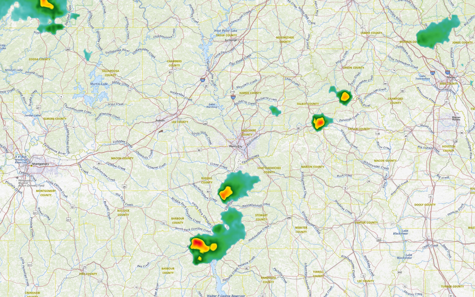
Heat index values will climb into the upper 90s to lower 100s today and Tuesday as unseasonably warm conditions settle in ahead of a cold front. The National Weather Service has placed a marginal risk for severe weather across north Georgia and central Alabama, with the primary threat coming from damaging wind gusts in the strongest storms. Yesterdayís repeated rounds of storms left pockets of cooler air behind that are now acting like small cold fronts, helping to trigger additional storm development this afternoon. Moisture has pooled well across northern Georgia ahead of a stalled frontal boundary, and weak upper-level support is allowing storms to fire off across the region. More seasonable temperatures are expected to arrive as early as midweek, with a pattern shift beginning Wednesday as high pressure builds in from the northeast. By Thursday, conditions should turn mostly dry and cooler, with highs in the mid 80s.
| Day | High | Low | Rain | Conditions |
|---|---|---|---|---|
| TONIGHT | — | 72° | 20% | Slight Chance Showers And Thunderstorms then Mostly Clear |
| TUE | 94° | 72° | 25% | Patchy Fog then Slight Chance Showers And Thunderstorms |
| WED | 91° | 69° | 24% | Mostly Sunny then Slight Chance Showers And Thunderstorms |
| THU | 85° | 63° | 11% | Mostly Sunny |
| FRI | 86° | 63° | 1% | Sunny |
| SAT | 87° | 61° | 1% | Sunny |
| SUN | 88° | 61° | 4% | Mostly Sunny |
Written by the CNAW 2 weather desk from CNAW 2 weather desk data. Last updated September 21, 2026 at 11:42 PM Eastern. Covering Columbus and Phenix City, Auburn–Opelika, LaGrange, Eufaula and the rest of the 19-county CNAW viewing area.