--°
Checking the sky…
radar nowcast · next hour
Now+3 hr+6 hr
--°
Checking the sky…
radar nowcast · next hour
Now+3 hr+6 hr
Is there a severe weather risk in the CNAW viewing area today?
A marginal risk for severe thunderstorms is in effect today and tomorrow across north Georgia and metro Atlanta, with damaging wind gusts the primary threat.
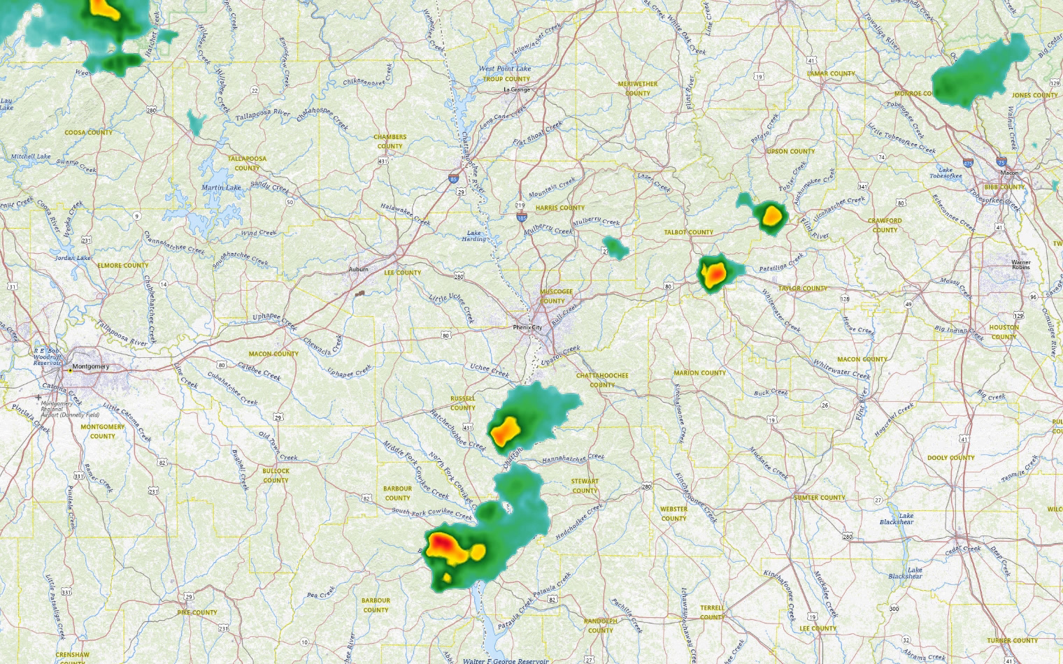
A marginal risk for severe weather is in effect today and tomorrow across north Georgia and metro Atlanta, with the primary threat being damaging wind gusts in the strongest storms. The setup is unusual: repeated rounds of storms yesterday created pockets of cooler air that act like small cold fronts, allowing new storms to develop as the afternoon heat builds. Moisture has pooled across northern Georgia ahead of a stalled frontal boundary, and weak upper-level support is helping storms fire off. Where instability is greatest—across northern Georgia into the Atlanta metro—some rapidly descending air from drier air aloft could produce wind gusts up to 60 mph in isolated cases. Shear remains very low and steering currents are weak, so any storms that develop will move slowly. Some isolated flash flooding is possible where storms train over the same areas.
| Day | High | Low | Rain | Conditions |
|---|---|---|---|---|
| TODAY | 94° | 71° | 27% | Patchy Fog then Chance Showers And Thunderstorms |
| WED | 91° | 69° | 24% | Mostly Sunny then Slight Chance Showers And Thunderstorms |
| THU | 84° | 63° | 22% | Slight Chance Rain Showers then Mostly Sunny |
| FRI | 86° | 63° | 1% | Mostly Sunny |
| SAT | 87° | 61° | 1% | Sunny |
| SUN | 87° | 61° | 3% | Mostly Sunny |
| MON | 89° | 62° | 5% | Mostly Sunny |
Written by the CNAW 2 weather desk from CNAW 2 weather desk data. Last updated September 22, 2026 at 8:00 AM Eastern. Covering Columbus and Phenix City, Auburn–Opelika, LaGrange, Eufaula and the rest of the 19-county CNAW viewing area.